VivePatagonia

Travel guideCoyhaique

The capital of Aysén, where the Carretera Austral becomes a cityProvincia de Coyhaique · Región de Aysén del General Carlos Ibáñez del Campo
Population
57,818
Founded
1929
Elevation
302 m

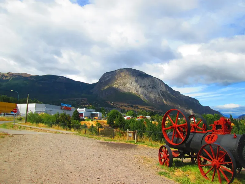
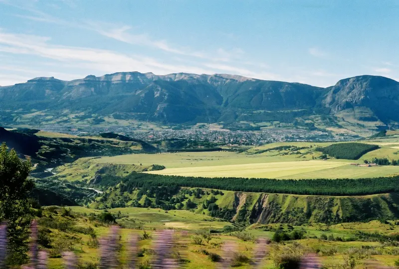
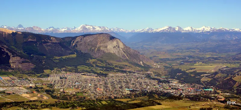
Coyhaique grew up where two rivers meet, the Simpson and the Coyhaique, beneath the sheer rock face of Cerro Mackay.

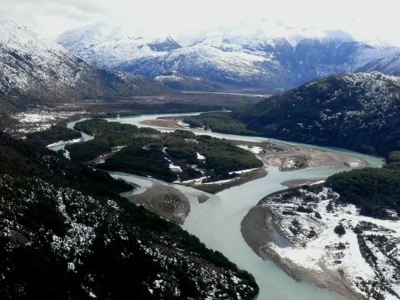
It is the only large city in the region and works as base camp for everything that comes after: from here, roads lead to Cerro Castillo, south along the Carretera Austral, to the fjords of Puerto Chacabuco and to rivers whose fly fishing is world-famous.

Its Plaza de Armas is pentagonal —five sides, with ten streets radiating out like spokes—, an unusual shape among Chilean town squares that was set in the town plan approved in 1930, and one worth seeing from above before exploring it on foot.

01

What to see and do

7 handpicked spots in and around Coyhaique, with the distance from the center and how long to set aside for each.

Coyhaique National ReserveNature

Coyhaique National Reserve

Lenga beech and coigüe forest five kilometers from downtown, with half-day trails and views over the city.

Some 2,150 protected hectares that begin where the city ends. The best-known trail reaches Laguna Verde in about two hours one way, through lenga beech, ñire beech and pines planted in the 1940s. From the viewpoints you can see all of Coyhaique, with Cerro Mackay across the way. It has a campground, a picnic area and a ranger station run by CONAF (Chile’s national forest service).
5 km awayHalf day

Season: Year-round; snow in winter

Rakela · CC BY-SA 3.0
Cerro Castillo National ParkAdventure

Cerro Castillo National Park

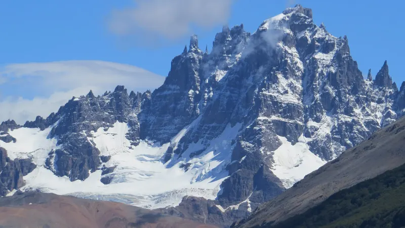
A 2,675-meter massif shaped like a fortress and one of the most beautiful treks in Chile.

The four-day circuit between Las Horquetas and Villa Cerro Castillo crosses mountain passes, forests and Laguna Cerro Castillo at the foot of the glacier. Those with less time can hike just to the lake: about 14 km and roughly eight hours round trip. The full traverse always requires a certified guide. In season you can hike to the lake on your own with the day pass sold by the association that manages the trails; in winter, only with a CONAF-approved guide. It is worth confirming the current rules before you go. Near Villa Cerro Castillo is the Paredón de las Manos (Wall of Hands), a rock art site.

64 km awayOne to four daysOfficial site

Season: November to April

Felipe.Alarcon · CC BY-SA 3.0
Río Simpson National ReserveNature

Río Simpson National Reserve

The river canyon on the way to Puerto Aysén, with the Velo de la Novia waterfall right beside the road.

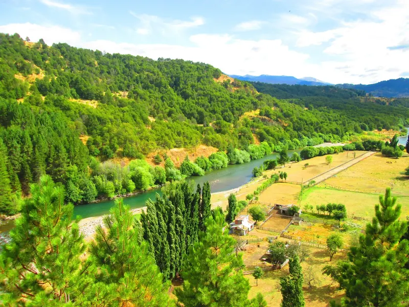
Route 240 runs through the reserve for nearly forty kilometers between rock walls and evergreen forest. The Velo de la Novia (Bridal Veil) waterfall drops right next to the road and requires no hiking; farther on there are short trails, an environmental information center and good fishing spots.

32 km away2 to 3 hours

Season: Year-round

Manxuc · CC BY-SA 4.0
Cerro Mackay and Piedra del IndioViewpoints

Cerro Mackay and Piedra del Indio

The volcanic rock mountain that towers over the city, and the stone profile you can spot from the bridge.

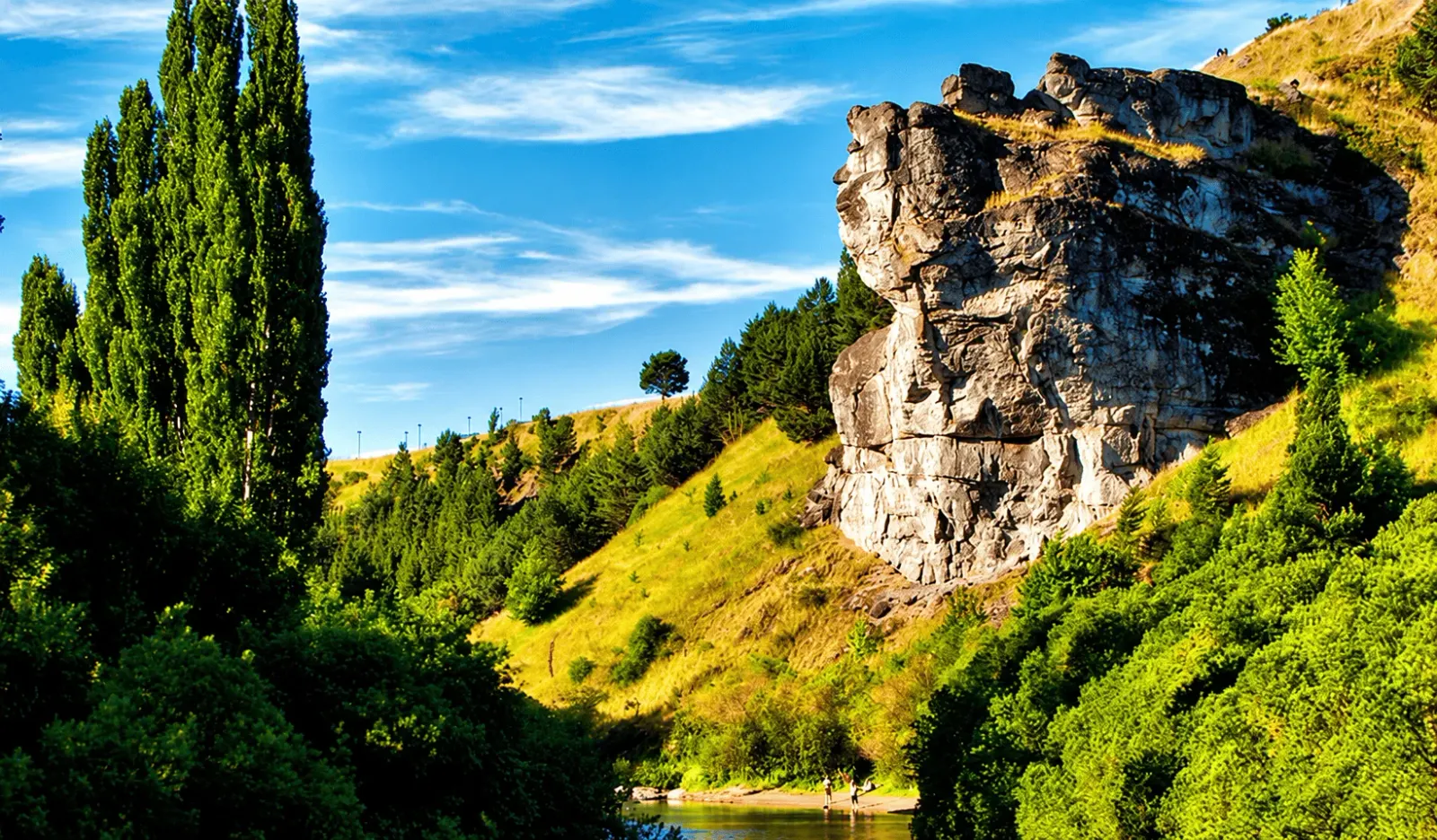
Cerro Mackay, at about 1,200 meters, rises in front of the city with walls of columnar volcanic rock, the remains of ancient volcanic necks; its west face has multi-pitch climbing routes for experienced climbers. From the bridge over the Río Simpson you can make out the Piedra del Indio, a formation whose profile resembles a face gazing at the sky. The trek up the mountain takes four to five hours round trip and rewards you with the best panoramic view of Coyhaique. Access crosses private land: it is worth confirming before you go.

2 km awayHalf day

Season: Year-round

Manxuc · CC BY-SA 4.0
Coyhaique at the foot of the surrounding hillsCulture

Pentagonal Plaza de Armas

A five-sided square, with ten streets radiating out like spokes.

Its design is attributed to surveyor Héctor Monreal, hired by regional governor (intendente) Luis Marchant, and it was set in the town plan approved in 1930. Around it are the cathedral, the Intendencia (regional government) building and the craft fairs; in summer it is the city’s meeting point, and in winter the place where the feria costumbrista (traditional folk fair) is set up.

In town1 hour

Season: Year-round

Don Fulano · CC BY-SA 2.0
The Baker River, one of Aysén's best-known fly-fishing riversAdventure

Fly fishing on the rivers of Aysén

Brown and rainbow trout in the Simpson, the Ñirehuao, the Baker and a dozen lakes.

Aysén is one of the most renowned fly-fishing destinations in the world, and Coyhaique is where the guides live. The season runs from October to May and requires a fishing license, which you can buy online or from the Servicio Nacional de Pesca (National Fisheries Service). There are rivers twenty minutes from the city and lodges reachable only by small plane.

Half day to several daysOfficial site

Season: October to May

Iñi Papi from Concepción, Chile · CC BY-SA 2.0
The Carretera Austral heading southAdventure

The Carretera Austral heading south

Route 7 leaves Coyhaique and runs south to Villa O’Higgins, 570 kilometers of lakes and glaciers.

Heading south you come to Villa Cerro Castillo, General Carrera Lake with the Marble Caves (Capillas de Mármol) at Puerto Río Tranquilo, the confluence of the Baker and Neff rivers and, at the end, Villa O’Higgins. The road is paved as far as Villa Cerro Castillo; farther south gravel predominates, with sections gradually being paved. It is wise to fill up with fuel in every town and carry a spare tire in good condition.

3 days to 2 weeks

Season: November to March

Chile365 · CC BY-SA 3.0

02

Where everything is

The town in green, the sights in orange. The zoom fits the farthest one on the list.

Loading map…

03

The weather, month by month

A cool temperate climate with rain spread throughout the year, heaviest in winter. Summers are mild and long —the average January high is around 20 °C— and winters are not extreme, but snow and ice on the roads are normal between June and August. The wind is constant and can change the feels-like temperature by several degrees in minutes: a windbreaker is useful all twelve months of the year.

Average highAverage lowRainfall
1023 mm a year
J
F
M
A
M
J
J
A
S
O
N
D
Average temperatures and monthly rainfall
MonthJFMAMJJASOND
High19.5°20.1°17.4°13.6°9.4°6°5.8°8.3°11.5°13.9°15.9°18°
Low8.9°8.5°6.9°4.6°2.6°0.2°-0.4°0.9°2.2°4°5.9°7.8°
Rainfall (mm)5847739712214011911761716257

1991-2020 climate normals from the Chilean Meteorological Service (Dirección Meteorológica de Chile), Teniente Vidal station (Coyhaique), retrieved from its climate services portal.

04

Getting to Coyhaique

By plane

from Santiago and Puerto Montt

Flights land at Balmaceda airport, 55 km from Coyhaique by paved road. At the airport there are car rentals and shared transfers that drop you at your hotel; book them ahead, since they run in sync with each flight.

2 h 20 min from Santiago; about 50 min from Balmaceda to the citySeveral flights a day year-roundLATAM, Sky Airline, JetSmart

By ferry

from Puerto Montt and Quellón

The ships dock at Puerto Chacabuco, 82 km from Coyhaique. It is the way to bring your own car without crossing into Argentina, and the voyage winds between islands and fjords.

24 to 30 hours at seaSeveral departures a week, more frequent in summerNaviera Austral

By bus

from Puerto Montt, Osorno and cities in Argentina

Overland from northern Chile, you have to cross into Argentina and re-enter through the Coyhaique or Huemules border pass. There are also regular services from Comodoro Rivadavia and Esquel.

20 hours or more from Puerto MonttWeekly departures, more frequent in summer

By car

from Carretera Austral (Route 7)

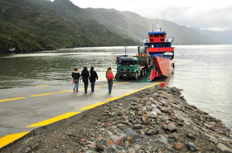
From the north, Route 7 arrives after the Hornopirén and Caleta Gonzalo ferries; from the south, it climbs up from Villa O’Higgins and General Carrera Lake. The northern ferries should be booked weeks in advance in high season.

Several days from Puerto MonttDaily ferries in summer, fewer in winter

Getting around once you are there

You can walk across downtown in twenty minutes. For everything else, renting a car is the best option: the sights are between 5 and 100 km away, and public transportation to them is scarce outside the high season. Within the city there are shared taxis (colectivos) on fixed routes, and daily buses run to Puerto Aysén, Villa Cerro Castillo and Balmaceda.

05

Before you set off

What locals take for granted and visitors find out too late.

The wind is in charge

It blows almost every day, and hard. Windproof clothing, layers and a hat come in handy even in January; umbrellas simply don’t work.

Fill up whenever you can

Coyhaique has several gas stations, but heading south you can go 200 km without seeing one. The local rule is to fill up in every town, even with half a tank left.

Book ahead in high season

Between December and February, lodging, transfers and ferries fill up weeks in advance. Outside those months, it’s a good idea to confirm that the service is running.

The signal drops out

Coverage is good in the city; on the road and in the parks it disappears. Downloading offline maps before you set out will save you more than one scare.

Last reviewed

The directory

Where to eat and stay in Coyhaique

253 restaurants, cafés and places to stay on the portal, with opening hours, menus and locations.