VivePatagonia

Travel guidePuerto Williams

The capital of the Antártica Chilena Province, on the Beagle ChannelProvincia Antártica Chilena · Región de Magallanes y de la Antártica Chilena
Population
1,868
Founded
1953
Elevation
3 m

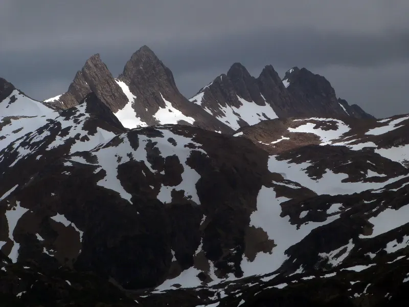
Puerto Williams is on Navarino Island, south of the Beagle Channel, and according to the classification of Chile’s National Statistics Institute (INE) it is the southernmost city in the world. Behind the town rise the Dientes de Navarino, a row of rock spires that gives its name to one of the southernmost treks in the world; in front of it runs the channel the Beagle sailed with Darwin on board.

It is also the last place where the memory of the Yagán people lives on, a people who navigated these channels for six thousand years. In Villa Ukika, at the edge of town, the community keeps the basket weaving and the story of that history alive, and is working to revitalize its language.

01

What to see and do

7 handpicked spots in and around Puerto Williams, with the distance from the center and how long to set aside for each.

Dientes de Navarino CircuitAdventure

Dientes de Navarino Circuit

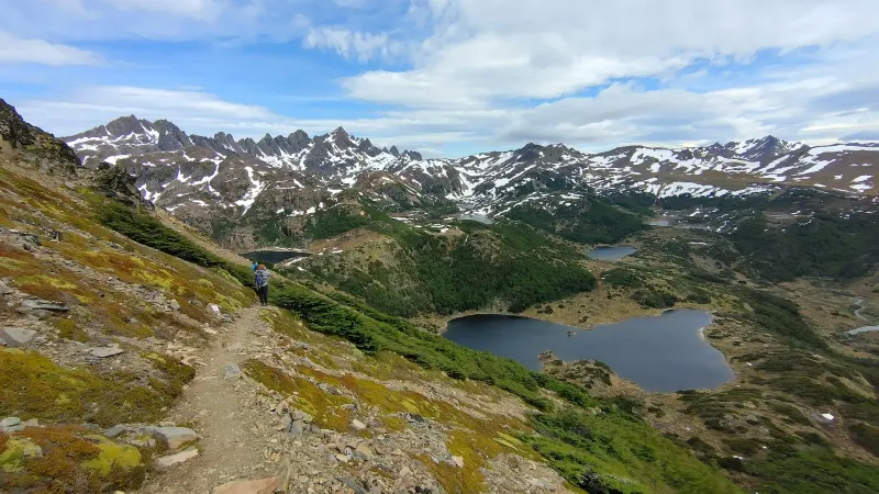
One of the southernmost treks in the world: five days among rock spires, lakes and peat bogs.

A self-guided circuit of about 53 kilometers that loops around the spires of the Dientes, crossing five mountain passes and several lakes. There are no refuges and no cell signal: you go with a tent, food and experience, and before setting out you register your route and return date with the Carabineros (Chilean police) in Puerto Williams, checking in again when you get back; it is worth confirming the procedure when you arrive. The best time is December to February, although cold, wind and snow can show up in any month: check conditions before you go.
3 km away4 to 5 days

Season: December to February

Lluis Cabarrocas Ribas · CC BY 2.0
The Róbalo River valley seen from the ridge that climbs to Cerro BanderaViewpoints

Cerro Bandera

Three to four hours round trip to the Chilean flag, with views over the town and the Beagle Channel.

It is the first stretch of the Dientes de Navarino circuit. The trail climbs from Puerto Williams through lenga beech forest to the Chilean flag, at about 600 meters, with views over the town and the Beagle Channel. It is of moderate difficulty, and it is worth checking the forecast before heading out.

3 km away3 to 4 hours

Season: November to April

Mat Austro · CC BY 4.0
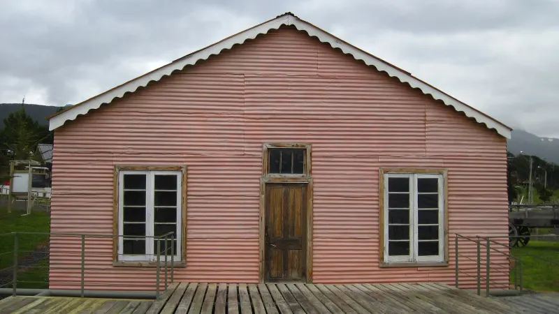
Casa Stirling, part of the Museo Territorial Yagán Usi complexCulture

Museo Territorial Yagán Usi

More than six thousand years of Yagán history, in the museum that changed its name at the community’s request.

Until 2024 it was called the Museo Antropológico Martin Gusinde. At the request of the Comunidad Indígena Yaghan de Bahía Mejillones, it reopened as the Museo Territorial Yagán Usi – Martín González Calderón, in honor of a tradition bearer from the community. It covers more than six thousand years of seafaring, hunting and basketry, with objects returned by the Museo Nacional de Historia Natural (National Museum of Natural History) and baskets by Yagán artisans such as Cristina Calderón.

In town1 to 2 hoursOfficial site

Season: Year-round

PaulaGiraudi · CC BY-SA 3.0
Culture

Villa Ukika

The Yagán community at the edge of town, where rush basketry is kept alive.

One kilometer east of downtown Puerto Williams lives part of the Yagán community: according to the Chilean Navy, the first families arrived from Mejillones in 1959. You can buy baskets woven from rush and learn about the work to revive the Yagán language, which is now the focus of a teaching effort within the community.

1 km away1 hour

Season: Year-round

Omora Ethnobotanical ParkNature

Parque Etnobotánico Omora

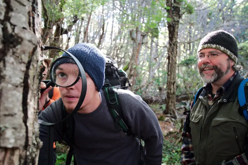
“Tourism with a hand lens”: the miniature forests of mosses and lichens of Cape Horn.

A research park linked to the Cape Horn Biosphere Reserve, where scientists study one of the highest concentrations of mosses, lichens and liverworts on the planet. The visit is done hand lens in hand, looking at a forest that fits on a rock. It is about four kilometers west of town, and the guided tour must be booked in advance.

4 km away2 to 3 hours

Season: October to April

Fabncampos · CC BY-SA 4.0
Cape HornNature

Cape Horn

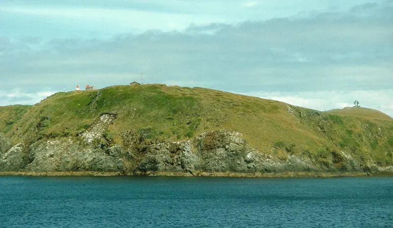
The end of the continent: the island, the lighthouse and the steel albatross silhouetted against the wind.

The cape is on Hornos Island, south of Navarino, and is reached on an expedition cruise or by charter flight when the weather allows. On the island there is a lighthouse staffed by the Chilean Navy, a chapel and the albatross monument, in memory of the sailors who died trying to round the cape.

110 km awayOne to several days

Season: December to March, weather permitting

Aah-Yeah · CC BY 2.0
Micalvi Yacht ClubCulture

Club de Yates Micalvi

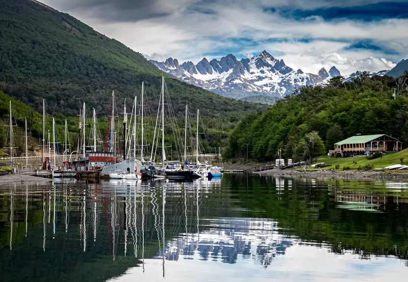
A German ship from 1925 that served as a Navy transport and is now home to the yacht club.

Built in Germany in 1925, the Micalvi spent more than three decades as a Chilean Navy transport in the southern channels; decommissioned in 1961, it stayed in Puerto Williams and is now the home of the Club Naval de Yates Micalvi: a meeting place for sailors from all over the world, who tie up there before continuing on to Cape Horn or the fjords. It is worth asking at the club whether they receive visitors.

1 km away1 hour

Season: Year-round

Autor no identificado (Wikimedia Commons) · CC0

02

Where everything is

The town in green, the sights in orange. The zoom fits the farthest one on the list.

Loading map…

03

The weather, month by month

A subpolar oceanic climate, surprisingly moderate: around 500 millimeters of precipitation a year and mild temperatures: the average January high is around 15 °C and the average July low around -1 °C. The hard part is not the cold but the instability: wind, rain, sun and snow can follow one another within an hour, and in the mountains that means going prepared even in January.

Average highAverage lowRainfall
497 mm a year
J
F
M
A
M
J
J
A
S
O
N
D
Average temperatures and monthly rainfall
MonthJFMAMJJASOND
High14.8°14.4°12.6°9.8°7.5°4.9°5.2°6.4°8.5°11°12.9°13.9°
Low6.2°6.1°4.6°2.5°1.3°-0.8°-0.9°-0.2°0.8°2.4°4.1°5.3°
Rainfall (mm)525348403845343632304048

Temperatures: 2016-2025 average from the climate yearbooks of the Chilean Meteorological Service (Dirección Meteorológica de Chile), Guardiamarina Zañartu station. Precipitation: 1991-2020 climate normal from the same station.

04

Getting to Puerto Williams

By plane

from Punta Arenas

The flight crosses Tierra del Fuego and the Beagle Channel in just over an hour, with views that make the window seat worth it. The planes are small and the baggage allowance is limited; wind can cancel flights, so it is wise to leave some slack in your plans.

1 h 15 minSeveral flights a week, daily in seasonAerovías DAP

By ferry

from Punta Arenas

The Yaghan crosses the strait and the Brecknock, Cockburn and Beagle channels on a voyage of about thirty-two hours that is, in practice, a fjord cruise at ferry prices. It has reclining seats and cabins.

About 32 hoursWeeklyTransbordadora Austral Broom

By ferry

from Ushuaia, Argentina

Boat crossings run over the Beagle Channel between Ushuaia and Puerto Navarino, with an overland transfer to Puerto Williams. They are seasonal and weather-dependent; border formalities are handled at both ports.

Half a day including transfersSeasonal, mainly in summer

Getting around once you are there

You can walk the town in twenty minutes, Villa Ukika included. The Cerro Bandera and Dientes trail is reached on foot, 40 minutes to an hour from the plaza. For Cape Horn, Puerto Toro or the Beagle, you need to charter a boat; there is no regular service.

05

Before you set off

What locals take for granted and visitors find out too late.

Register before heading into the mountains

For the Dientes de Navarino, you must register your route and return date with Carabineros (Chile’s national police) before setting out, and check in when you get back; it’s a good idea to confirm the procedure when you arrive. There is no quick rescue: you are on your own.

Cash, just in case

There is an ATM, but it runs out of bills and the connection fails. Arriving with cash in Chilean pesos saves you trouble.

If you don’t bring it, it isn’t here

Supplies arrive by boat. Specific medications, batteries, spare parts and trekking food are best brought from Punta Arenas.

The wind decides

Flights and boat trips are canceled often. Leaving one or two days of margin before an international flight isn’t overcautious; it’s what locals do.

Last reviewed

The directory

Where to eat and stay in Puerto Williams

17 restaurants, cafés and places to stay on the portal, with opening hours, menus and locations.