VivePatagonia

Travel guidePunta Arenas

The capital of the Strait of MagellanProvincia de Magallanes · Región de Magallanes y de la Antártica Chilena
Population
148,391
Founded
1848
Elevation
34 m

Punta Arenas is the largest city in Chilean Patagonia and the only one built facing a strait that the whole world once sailed through.

Before the Panama Canal, every ship traveling from the Atlantic to the Pacific passed this way, and that wealth is still written in the mansions around Plaza Muñoz Gamero and in a cemetery you can tour like a museum.

From its docks, ships leave for Antarctica, Tierra del Fuego and the penguin colonies. It is a city of immigrants —Croatian, English, Spanish, Swiss— and it shows in the surnames, the food and the way people speak.

01

What to see and do

8 handpicked spots in and around Punta Arenas, with the distance from the center and how long to set aside for each.

Plaza Muñoz Gamero, the main square of Punta ArenasCulture

Plaza Muñoz Gamero

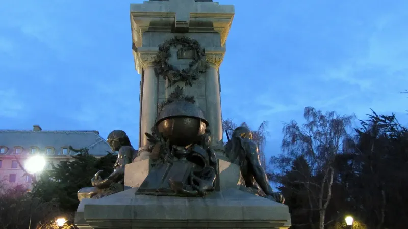
The heart of the city, surrounded by mansions from the wool-boom years.

At its center stands the monument to Ferdinand Magellan, with the bronze foot of the Patagon Indigenous figure that local custom says to kiss before leaving the city, to make sure you come back. Around it, the Palacio Sara Braun, the Club de la Unión and the cathedral tell of the fortune left behind by wool and passing ships.
In town1 hour

Season: Year-round

Sculpture: Guillermo Córdova; photo: Farisori · CC BY-SA 3.0
Sara Braun Municipal CemeteryHistory

Cementerio Municipal Sara Braun

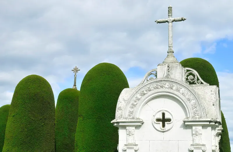
Avenues of clipped cypresses and mausoleums that tell the story of immigration to Magallanes.

A Historic Monument since 2012 and often cited among the most beautiful cemeteries in the world. The mausoleums of the Braun, Menéndez and Nogueira families stand alongside the humble graves of Croatian immigrants and the memorial to the unknown Indigenous man, which still receives flowers from people who never knew him.

1 km away1 to 2 hours

Season: Year-round

LBM1948 · CC BY-SA 4.0
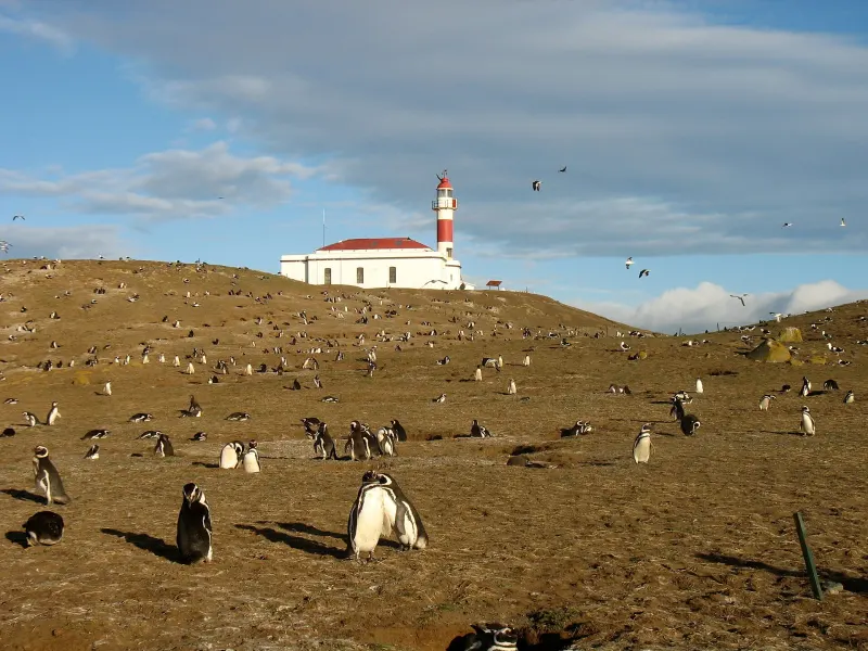
Los Pingüinos Natural Monument (Isla Magdalena)Wildlife

Los Pingüinos Natural Monument (Isla Magdalena)

An island in the middle of the strait with a colony of Magellanic penguins.

Magellanic penguins nest there, although the colony has declined sharply: CONAF (Chile’s national forest service) estimated about 7,000 pairs in 2025, compared with nearly 60,000 in the early 2000s. A roped-off trail leads from the beach to the lighthouse, and the penguins cross the path unfazed. It is reached by boat from the Tres Puentes terminal, passing Isla Marta and its sea lions.

35 km awayHalf day

Season: October to March; some years, until mid-April

PaulaGiraudi · CC BY-SA 3.0
Fuerte Bulnes and Strait of Magellan ParkHistory

Fuerte Bulnes and Strait of Magellan Park

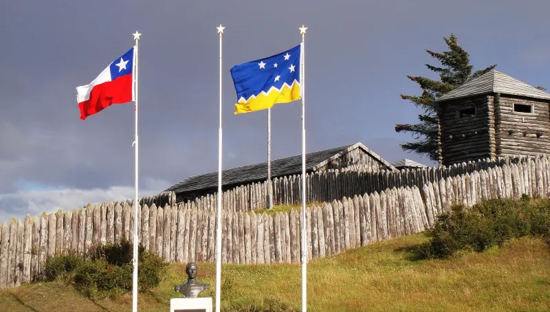
The reconstruction of the fort with which Chile took possession of the strait in 1843.

Fifty-two kilometers south on Route 9, at Punta Santa Ana. The log fort has been rebuilt on its original site, and the park around it explains the history of navigation in the far south. Nearby are the Faro San Isidro lighthouse and the viewpoint where Chile’s mainland road comes to an end.

62 km awayHalf day

Season: Year-round

Magallanes1 · CC BY-SA 3.0
Nao Victoria MuseumHistory

Museo Nao Victoria

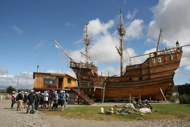
Full-size replicas of Magellan’s ship, the schooner Ancud, the Beagle and Shackleton’s boat.

You can go aboard the replica of the Nao Victoria, the only ship of Magellan’s expedition to complete the first voyage around the world. Beside it are the schooner Ancud, HMS Beagle and the James Caird, the boat in which Shackleton crossed more than 1,300 kilometers of open ocean to get help. It is about seven and a half kilometers north of downtown.

8 km away1 to 2 hoursOfficial site

Season: Year-round

Juanmatassi · CC BY-SA 3.0
Magallanes Regional MuseumCulture

Museo Regional de Magallanes

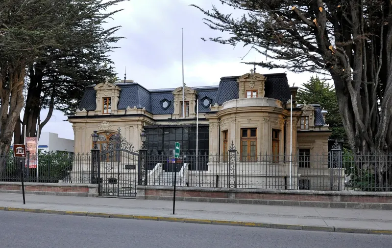
The Palacio Braun Menéndez, with the family’s original furnishings intact.

A house from 1905 preserved just as it was left: carpets, French furniture, the billiard room and the conservatory. Without any speeches, it shows how life was lived at the top of Magallanes society while a tin-roofed city was going up outside.

In town1 hour

Season: Year-round

P. Hughes · CC BY 4.0
Cerro de la CruzViewpoints

Cerro de la Cruz

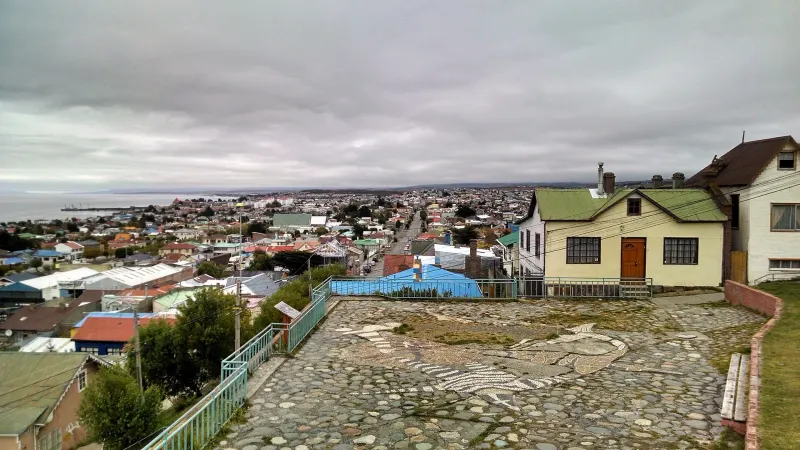
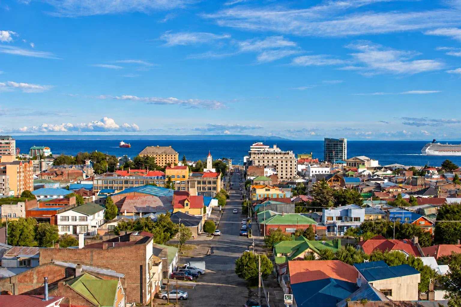
The viewpoint four blocks from the plaza: colorful rooftops, the strait and Tierra del Fuego in the distance.

It is a fifteen-minute walk up from downtown. From the top the whole city makes sense at a glance: the painted zinc roofs, the piers, the strait and, on clear days, the outline of Tierra del Fuego and Monte Sarmiento.

1 km away30 minutes

Season: Year-round

User:Maxvillarroeldouglas · CC BY-SA 3.0
Magallanes National ReserveNature

Magallanes National Reserve

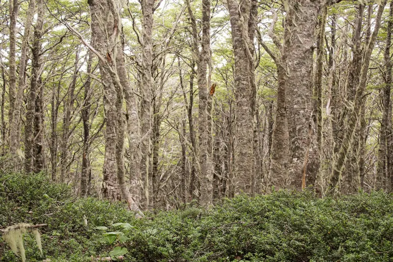
Lenga beech forest and snowy trails eight kilometers from downtown.

Known locally as the Reserva Forestal, it has signposted trails through lenga and coigüe forest, a viewpoint over the city and, in winter, the Cerro Mirador ski area, one of the few in the world where you can see the sea as you ski down.

8 km awayHalf day

Season: Year-round; skiing June to September

Natalia Reyes Escobar · CC BY-SA 4.0

02

Where everything is

The town in green, the sights in orange. The zoom fits the farthest one on the list.

Loading map…

03

The weather, month by month

A cold steppe climate, surprisingly dry: less than 400 millimeters of rain a year, falling as short drizzles. What defines the weather is not the rain but the wind, which blows steadily in spring and summer and knocks several degrees off how cold it feels. Summer highs are around 15 °C and winter highs around 4 °C; it snows from June to September.

Average highAverage lowRainfall
390 mm a year
J
F
M
A
M
J
J
A
S
O
N
D
Average temperatures and monthly rainfall
MonthJFMAMJJASOND
High15.3°14.8°13°10.1°6.9°4.3°4.2°5.7°8.3°10.8°12.9°14.3°
Low6.9°6.6°5.4°3.5°1.5°-0.5°-0.7°0.1°1.4°2.7°4.5°5.8°
Rainfall (mm)383243453731313025252332

1991-2020 climate normals from the Chilean Meteorological Service (Dirección Meteorológica de Chile), Carlos Ibáñez del Campo station (Punta Arenas), retrieved from its climate services portal.

04

Getting to Punta Arenas

By plane

from Santiago, Puerto Montt and Concepción

Presidente Carlos Ibáñez del Campo airport is 20 km north of the city. The terminal has transfers timed to each flight, taxis and car rentals. Small planes also fly from here to Puerto Williams and Porvenir.

3 h 20 min from SantiagoSeveral flights a day year-roundLATAM, Sky Airline, JetSmart, DAP

By bus

from Puerto Natales, Río Gallegos and Ushuaia

Punta Arenas is the bus hub of Chile’s far south. There are departures to Puerto Natales almost hourly in season, and daily services to Argentina crossing at the Integración Austral border pass.

3 h to Puerto Natales; 10 to 12 h to UshuaiaDailyBuses Fernández, Bus Sur, Buses Pacheco

By ferry

from Porvenir and Puerto Williams

The ferry to Porvenir, in Tierra del Fuego, sails from the Tres Puentes terminal, and the ship to Puerto Williams, on Navarino Island, leaves from the Arturo Prat pier. Schedules change with the season and sea conditions: it is best to confirm them the same day.

2 h 20 min to Porvenir; about 32 h to Puerto WilliamsAlmost daily to Porvenir; weekly to Puerto WilliamsTransbordadora Austral Broom

By cruise ship

from Ushuaia and Antarctica

Punta Arenas is a departure port for Antarctic expeditions and a port of call for cruises through the Fuegian channels and Cape Horn.

Season from October to March

Getting around once you are there

The historic center is easy to explore on foot at a leisurely pace. City buses and shared taxis (colectivos) run to the neighborhoods and the Zona Franca (duty-free zone), and there are car rentals at the airport and downtown for trips to Fuerte Bulnes, Seno Otway or Puerto Natales. For Isla Magdalena and Tierra del Fuego, boats leave from the Tres Puentes terminal, five kilometers north.

05

Before you set off

What locals take for granted and visitors find out too late.

The ropes along the street aren’t decoration

In spring and summer the wind often tops 100 km/h, and the city installs ropes along some downtown sidewalks for people to hold on to. Walking into the wind is tiring: allow more time than it seems you’ll need.

Sunscreen in summer

The ozone layer is thinner at this latitude, and the sun burns even when the day is cool. Sunscreen and sunglasses, even when it’s cloudy.

Zona Franca

The Zona Franca (duty-free zone), north of the city, sells electronics and technical clothing without VAT. It’s where locals buy their mountain jackets.

Penguins have a season

Isla Magdalena and Seno Otway can only be visited between October and March, when the colonies are on land. Outside those months there is nothing to see: they are out at sea.

Last reviewed

The directory

Where to eat and stay in Punta Arenas

343 restaurants, cafés and places to stay on the portal, with opening hours, menus and locations.