VivePatagonia

Travel guideTorres del Paine

The massif that defines PatagoniaProvincia de Última Esperanza · Región de Magallanes y de la Antártica Chilena
Photo: Taconvino · Public domain

Torres del Paine National Park, in the commune of the same name, is the most visited park in Chilean Patagonia, about 112 km from Puerto Natales.

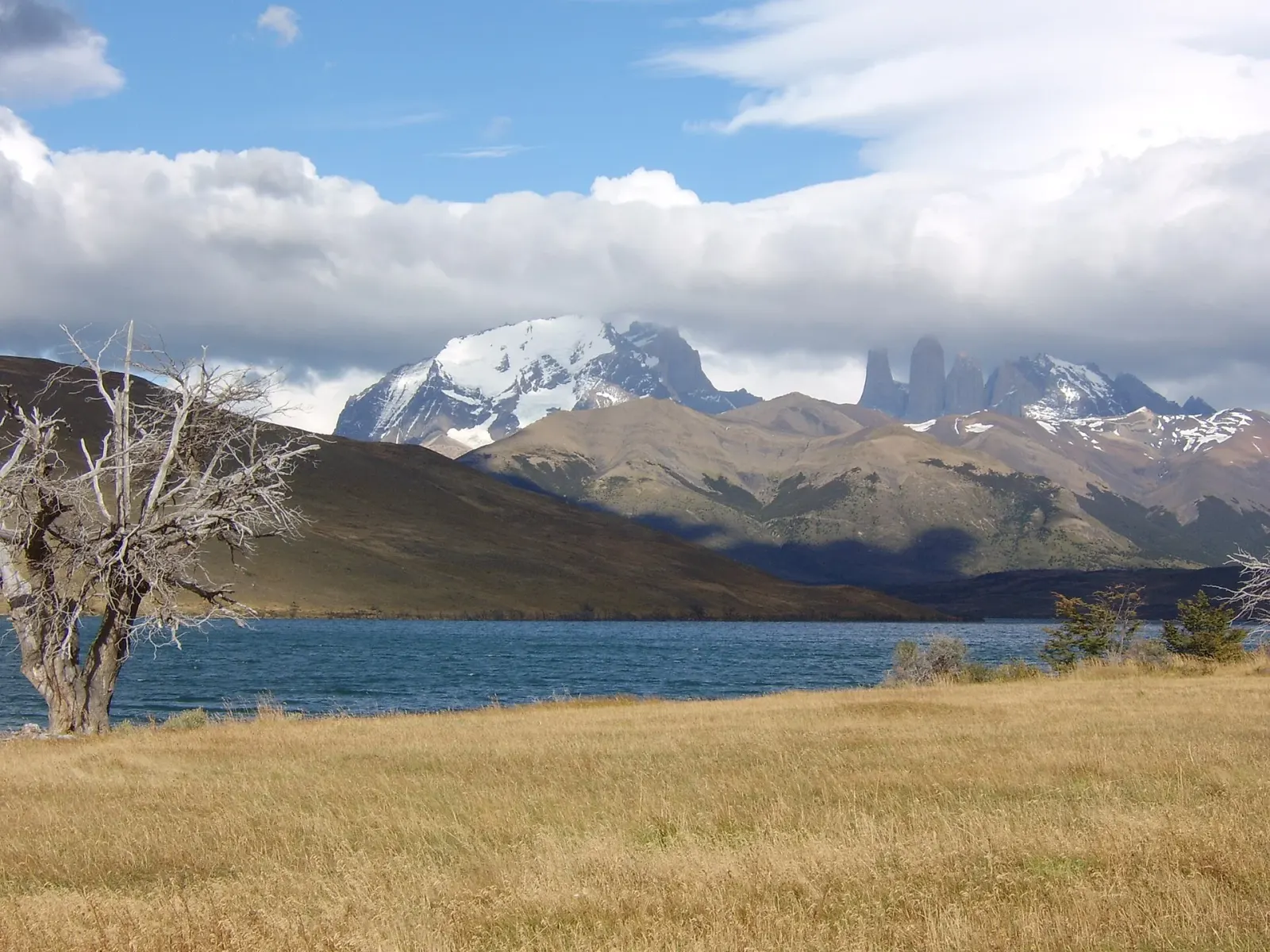
It is run by CONAF, was created in 1959, and was declared a UNESCO Biosphere Reserve in 1978. Among its lakes—Grey, Pehoé, Nordenskjöld, Sarmiento and Dickson—and the glaciers that descend from the Southern Patagonian Ice Field rise the granite towers and horns that give the park its name.

It is also home to guanacos, pumas, condors and huemuls (South Andean deer). You can see it on a day trip or on multi-day treks, and either way it pays to plan ahead: the park has strict rules, changeable weather and very limited services.

01

What to see and do

12 handpicked spots in and around Torres del Paine, with the distance from the center and how long to set aside for each.

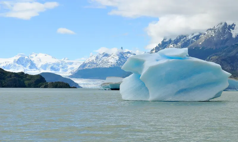
A blue iceberg floating on Lake Grey, with Grey Glacier in the backgroundNature

Lake Grey and Grey Glacier

Blue icebergs and a glacier from the Southern Patagonian Ice Field that ends in the lake.

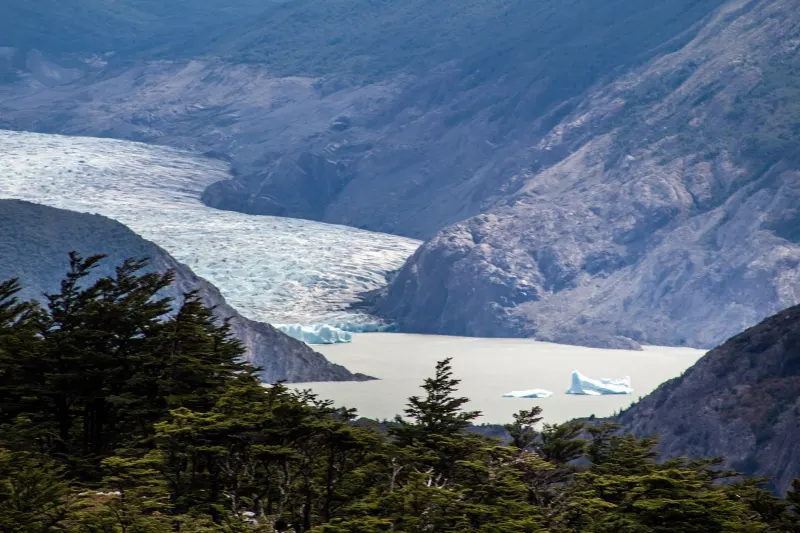
Grey Glacier descends from the Southern Patagonian Ice Field and ends in Lake Grey, which usually has icebergs floating near its shores. In the park there is a loop trail of about 5.5 km, of moderate difficulty, to the lake beach with a view of the glacier, and day tours usually include a boat trip to the glacier front. Wind and cold are intense: dress warmly.

LBM1948 · CC BY-SA 4.0
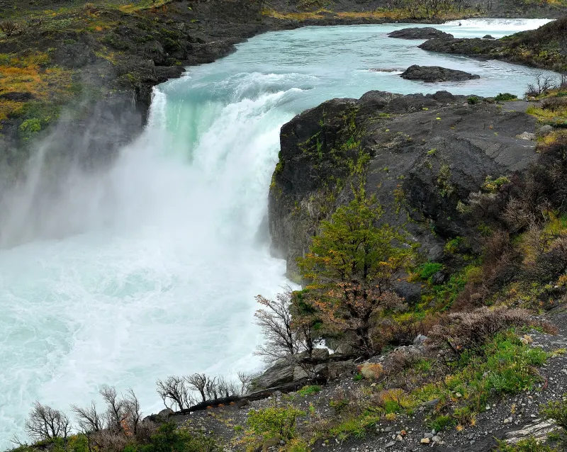
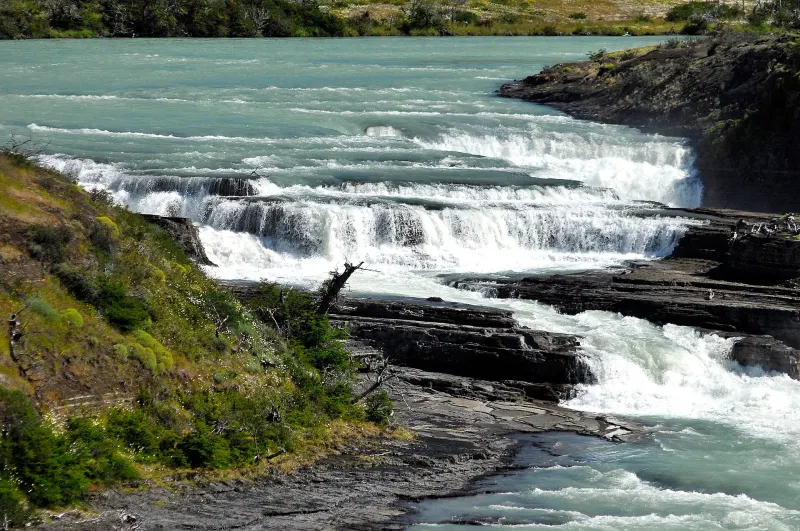
Salto Grande, the Paine River waterfall, in Torres del Paine National ParkNature

Salto Grande

The park’s largest waterfall, between lakes Nordenskjöld and Pehoé.

The park’s main waterfall carries the waters of Lake Nordenskjöld into Lake Pehoé, in a drop of about 15 meters. It is reached by a short, easy walk of about one kilometer on a flat path.

30 minutes
LBM1948 · CC BY-SA 4.0
The Paine River waterfall, with turquoise-green waterNature

Paine River Waterfall

A waterfall on the Paine River, beside the road to Laguna Azul.

It is in the Laguna Amarga sector, next to the road to Laguna Azul and about 6 km from the Laguna Amarga entrance. It is an easy stop and part of the day tours of the park.

LBM1948 · CC BY-SA 4.0
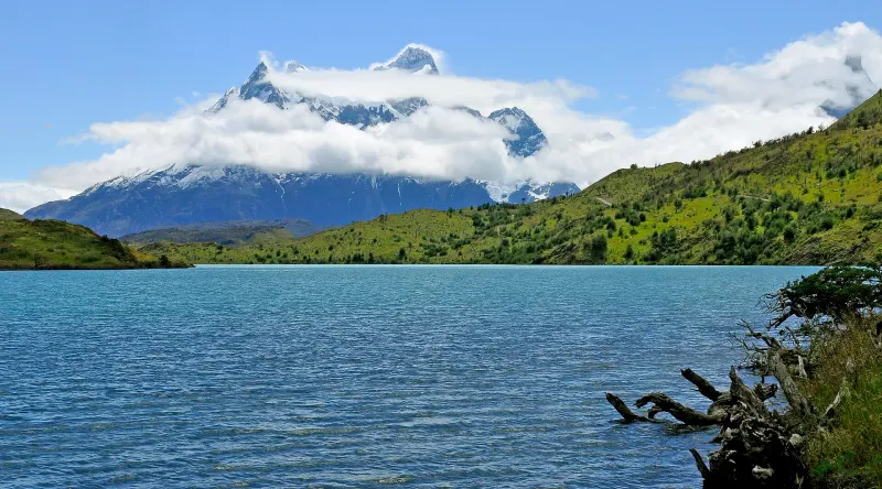
Lake Pehoé with Paine Grande mountain wrapped in cloud in the backgroundNature

Lake Pehoé

Turquoise waters facing the Paine range, with two viewpoints.

One of the park’s great lakes, with turquoise water. A viewpoint shows the whole length of the lake with the Paine range behind it, and another trail follows the shore through lenga and ñirre forests.

LBM1948 · CC BY-SA 4.0
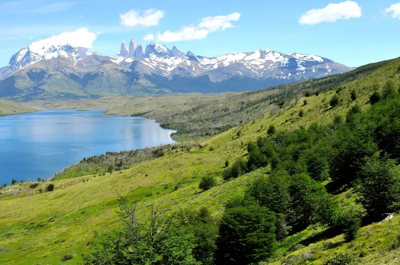
Laguna Azul with a hillside of lenga trees and, in the background, the Torres del PaineNature

Laguna Azul

A lagoon in the eastern part of the park, with the Towers in the background.

It is in the eastern part of the park, about 20 minutes by car from Laguna Amarga. From where you leave the vehicle, the viewpoint is less than five minutes away over flat ground, with the Torres del Paine in the background. Trails in the area start from the CONAF ranger post.

LBM1948 · CC BY-SA 4.0
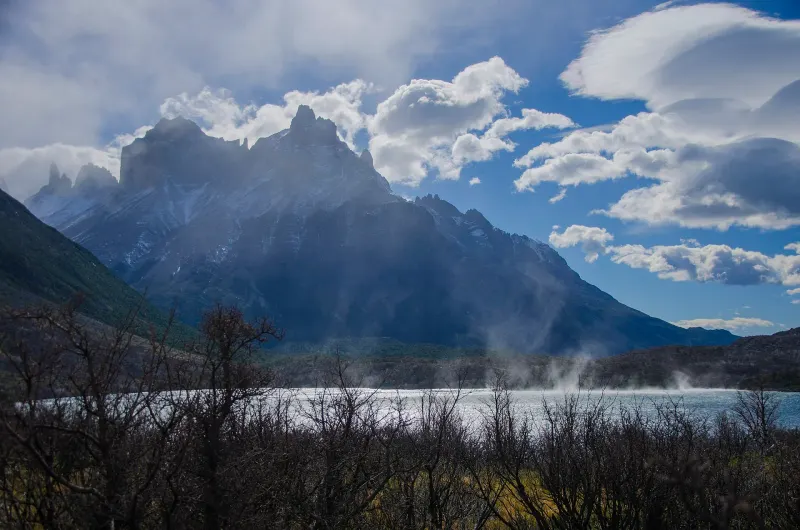
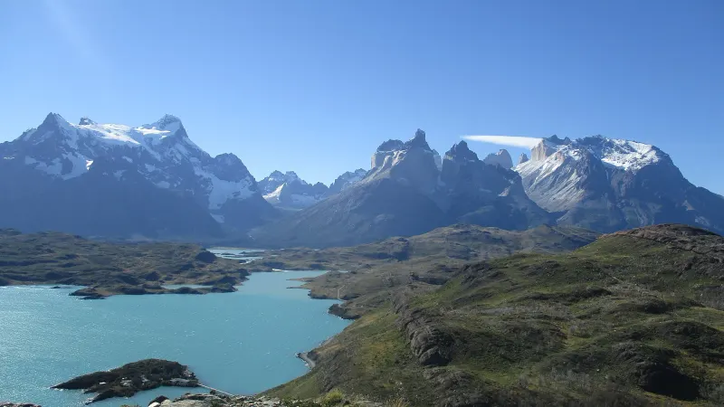
Lake Nordenskjöld with the Cuernos del Paine in the backgroundViewpoints

Nordenskjöld Viewpoint

Lake Nordenskjöld at the foot of the Cuernos del Paine.

A viewpoint on the shores of Lake Nordenskjöld, with the Cuernos del Paine behind. The round-trip trail is about 6 km and easy.

Alejandro Lizama · CC BY-SA 3.0
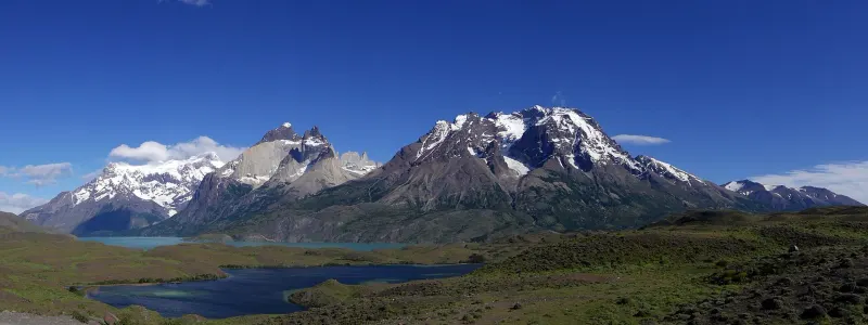
Panorama of the Paine Massif and its lagoons on a clear dayAdventure

Paine Massif Circuit (O)

The full loop around the massif: a week or more of trekking.

The park’s longest trek circles the entire Paine Massif, normally in seven to ten days and about 130 km (sources vary). It is walked in one direction only, counterclockwise, and its highest point is John Gardner Pass, at about 1,200 m. You must have camping or refuge reservations confirmed for every night before entering, and CONAF regulates access with daily quotas and registration, which have changed in recent years: check current conditions before you plan.

7 to 10 days
Steineschubser · CC BY-SA 4.0
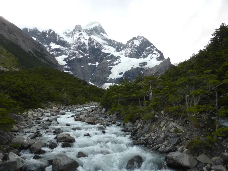
The French River and Paine Grande mountain at the end of the French ValleyAdventure

W Circuit

The park’s best-known trek: the French Valley, Base Torres and Grey Glacier.

A W-shaped route linking the French Valley, the base of the Towers and Grey Glacier, normally in four or five days. There are mountain refuges and campsites along the way, and a confirmed reservation for every night is required. In the winter season, from May to September, CONAF has required a guide for the W Circuit and Base Torres; the requirement changes from year to year, so confirm it before you go.

4 to 5 days
CARLOS TEIXIDOR CADENAS · CC BY-SA 4.0
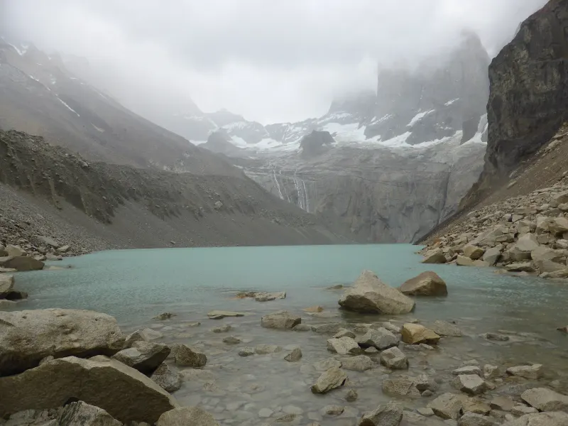
The lake beneath the towers, seen from the Base Torres viewpoint, with the peaks in the mistAdventure

Base Torres

The hike to the viewpoint of the granite towers.

This is the trail to the foot of the Torres del Paine: about 20 km round trip, 7 to 10 hours depending on pace and stops, with a final climb to the lake below the towers. The park’s trails have a closing time, so start early. In winter CONAF has required a guide for this trail, as for the W Circuit; check current conditions.

7 to 10 hours
CARLOS TEIXIDOR CADENAS · CC BY-SA 4.0
The Cuernos del Paine and Lake Pehoé seen from the trail to Cóndor ViewpointViewpoints

Cóndor Viewpoint

A short climb with views of Lake Pehoé and the Cuernos del Paine.

A round-trip trail of about 2.4 km, of moderate difficulty, that climbs in one to two hours to a viewpoint over Lake Pehoé, with the Cuernos del Paine in the background.

1 to 2 hours
MARIA JOSE VARELA · CC BY-SA 4.0
Grey Glacier seen from Ferrier ViewpointViewpoints

Ferrier Viewpoint

A viewpoint separate from the circuits, with a view of Grey Glacier.

A trail of about 5.6 km, considered difficult, that is not part of the W Circuit or the Paine Massif and must be planned separately. The access road is gravel and the summit is fully exposed to the wind. From the top you can see Grey Glacier.

Natalia Reyes Escobar · CC BY-SA 4.0
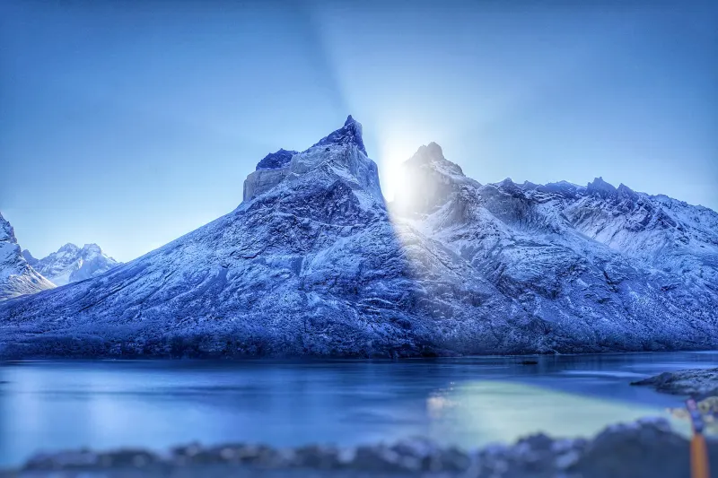
The sun peeking out between the Cuernos del Paine, seen from Cuernos ViewpointViewpoints

Los Cuernos Viewpoint

An almost flat walk to Lake Nordenskjöld, beneath the Cuernos del Paine.

A round-trip trail of about 6.4 km, moderate and almost flat, leading to a viewpoint over Lake Nordenskjöld facing the Cuernos del Paine. It takes about two hours.

2 hours
Jan Balaguer · CC BY-SA 4.0

02

Where everything is

The town in green, the sights in orange. The zoom fits the farthest one on the list.

Loading map…

03

The weather

Weather today and the next four days

Loading the forecast…

The park is known for its changeable weather and complex geography, and wind is one of its defining features. Always carry the right gear.

04

Getting to Torres del Paine

By bus

from Puerto Natales

You can get there by regular bus, tourist transfer (shared or private) or rental car. Most services enter through the park’s entrances.

About 2 hoursDaily services in season

By bus

from Punta Arenas

You travel first to Puerto Natales and continue from there on the road toward Torres del Paine.

By car

from Own or rental vehicle

This is the way to have flexibility with schedules, stops and viewpoints. Keep in mind the changeable weather and wind, and fill up on fuel before entering: there are no gas stations in the park.

By plane

from Puerto Natales or Punta Arenas

You fly to Puerto Natales or Punta Arenas and then continue overland to the park. From Puerto Natales it is the most direct access.

Getting around once you are there

Inside the park there are more than 100 km of internal roads and plenty of places to stop. If you don’t have your own vehicle and don’t want to rent one, the usual option is a “full-day” tour from Puerto Natales or Punta Arenas: a day visit by public transport is not possible. There are no ATMs or gas stations in the park, so stock up in Puerto Natales; the mountain refuges, campsites and lodgings have shops with non-perishable food and basic gear.

05

Before you set off

What locals take for granted and visitors find out too late.

No open fires

Open fires are strictly prohibited, and camp stoves may only be used in designated areas. Breaking the rules can result in legal penalties or expulsion from the park.

Pack out your trash and camp only where allowed

You must carry out all trash and polluting items, and camp only in authorized areas: a lapse can cause irreversible environmental damage.

Weather that changes

The park is known for its changeable weather and complex geography: always carry the right gear.

Visiting for the day? Arrive early

There are more than 100 km of internal roads and plenty of places to stop. To make the most of your time and enjoy it unhurried, come very early. Hiking trails have a closing time.

No car? Take a “full-day” tour

If you don’t have your own vehicle and don’t want to rent one, book a “full-day” tour in Puerto Natales or Punta Arenas: the agencies know the travel times and the main attractions. A day visit by public transport is not possible.

Stock up before you enter

There are no ATMs or gas stations in the park: stock up in Puerto Natales. The mountain refuges, campsites and lodgings have shops with non-perishable food and basic gear, as well as basic sanitary facilities.

Book ahead

In the summer season, from November to March, book your accommodation in advance. For the treks, CONAF requires a valid ticket and confirmed camping or refuge reservations for every night of the itinerary.

Winter: ask about a guide

In the winter season, from May to September, CONAF has required an accredited guide for the W Circuit and Base Torres, along with gear such as microspikes and trekking poles. The requirement changes with conditions, so confirm it before you go.

No drones

Drones are prohibited in any area of the park.

Last reviewed

The directory

Where to eat and stay in Torres del Paine

We are still adding businesses from this town to the portal.