By Equipo VivePatagoniaEditorial team
During the first decades of settlement, nearly everything that reached Aysén came in up this river, and the same river carried out whatever the estancias (large sheep ranches) produced. Puerto Aysén was never just another town in the region: it was the front door. Walking it means tracing what is left of that history and seeing how the town reinvented itself once the ships could no longer come in.
A port that began upriver
The first settlement, Puerto Dunn, stood about eight kilometers upriver. From there it moved down to the river mouth, to a spot people called Media Agua, where the Sociedad Industrial de Aysén, the great ranching concession of the area, paid for the river port.
When the Territory of Aysén was created at the end of 1927, Puerto Aysén became its capital, and in 1928 it was granted the status of a city. Under Luis Marchant, the same carabinero (police officer) who pushed for the founding of Coyhaique, its administrative buildings went up.
The Land Office
On the corner of Esmeralda and O’Higgins, part of the Plaza de Armas ensemble, a 1930 building still stands: the former Oficina de Tierras y Colonización (Land and Settlement Office). For some fifty years, this is where land was handed out to settlers. Few buildings explain so well how the region was populated.
It was built by Carlos Stange Klein, a timber man from Puerto Montt, with twenty-centimeter lenga beech stud walls and foundations that rise thirty centimeters above the ground to keep out the damp: architecture made for a place where it rains almost all year. It has been a Historic Monument since 2009 and is used for something else today, so you admire it from the street.
The river that filled up
By around 1950 there were already warnings that the river was silting up. In the 1960s the sediment forced the port to move to Chacabuco Bay, some fifteen kilometers away. The Consejo de Monumentos Nacionales (National Monuments Council) explains it as a consequence of erosion: the soil the rains washed down from the hills ended up in the riverbed.
Then the town lost its role as capital, too. With the regionalization of 1974, the capital of the new Aysén Region went to Coyhaique. The Museo Regional de Aysén (Aysén Regional Museum) tells both stories as part of the same shift: the silted river, the port that moved to Chacabuco and the capital that moved inland.
The bridge
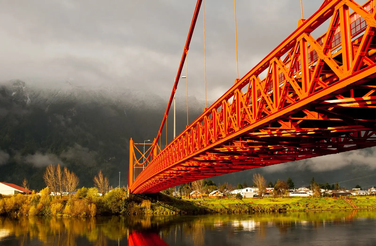
The Puente Presidente Ibáñez is the town’s postcard view and also a chapter in this story. It was Carlos Ibáñez del Campo’s initiative; work began in 1961, took five years, and Eduardo Frei Montalva inaugurated it in 1966. With the river already silted up, the bridge linked Puerto Chacabuco to the interior of the region.
It is a 210-meter suspension bridge with two steel arches 25 meters high, and its metal structure was designed and built in Germany by the firm Krupp Rheinhausen. It has been a Historic Monument since 2002. Looking at it from the bank, with the river below and the hills behind, is the best way to understand why the town has made it its emblem.
From river to fjord
The fifteen kilometers to Puerto Chacabuco show the whole transformation: the wide river opens into the fjord, the hills drop down to the water, and the ships appear that could never make it up the river now. Chacabuco is Aysén’s port and the starting point for boat trips into the fjords and to Laguna San Rafael.
Getting around
- The center is walkable. The plaza and the old Land Office sit right next to each other.
- Truly waterproof clothing. This is one of the rainiest areas in Chile, and no month is dry.
- If you’re heading out on the water from Chacabuco, confirm the departure that same day: it depends on sea conditions.
Last reviewed
See the full guide to Puerto Aysén