By Equipo VivePatagoniaEditorial team
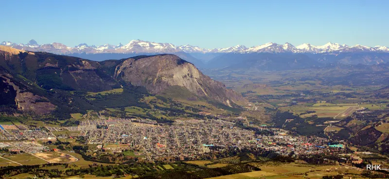
Coyhaique is a young city that takes its symbols seriously. Almost all of them are within walking distance and, taken in order, they tell a single story: that of a region you could reach overland only by crossing Argentina, and of the people who came to stay.
The full loop is about six kilometers. With stops and no rush, it makes a half-day outing.
1. A five-sided plaza
The Plaza de Armas is a pentagon with ten streets radiating from it, and the city’s grid only straightens out a few blocks beyond. It’s worth looking at it on a map first, because from the ground the shape is hard to make out.
The layout already appeared on the plan of the “Población Baquedano” approved in 1930, when the plaza was called Coronel Marchant, and its design is credited to the surveyor Héctor Monreal. In the plaza stand a bust of Luis Marchant González, the carabinero (police officer) who arrived as governor in 1928 and pushed for the town’s founding, and the “Firma Baquedano” monolith, which bears the founding charter and the city’s coordinates.
That charter has a story of its own. The official founding date is October 12, 1929, but the document only came to light in 1931, and some historians doubt the ceremony ever took place. The name didn’t last either: in the 1930s, Baquedano was renamed Coyhaique to avoid confusion with another Baquedano, in the Antofagasta Region. The new name comes from the Aónikenk, or Tehuelche, language and translates as “camp by the lagoon” or “camp between waters,” depending on the source.
2. The crafts market
Beside the plaza is the crafts market, with work in wool, leather, ceramics, stone and wood. It’s the place to buy from the people who make things, and to ask them how they make them.
3. El Ovejero (The Shepherd)
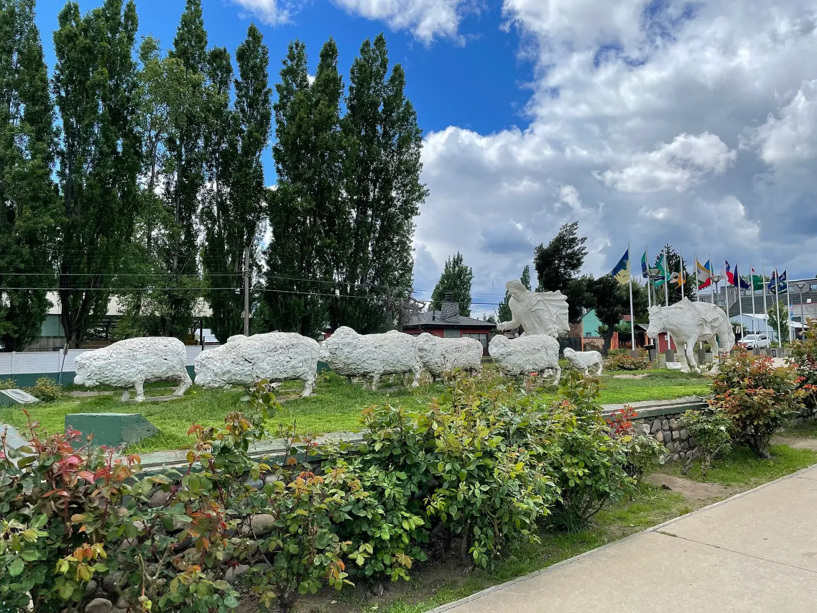
About four hundred meters away, on the median of Avenida General Baquedano, a ranch hand leans into a blizzard with his horse, two dogs and eight sheep: twelve figures in all. It’s the work of sculptor Germán Montero, who drew inspiration from the poem “El ovejero de mi tierra” (The Shepherd of My Land), by José Grimaldi Acotto.
It’s also the stop to put a finer point on the “gaucho city” label. The shepherds on the estancia (large sheep ranch) of the Sociedad Industrial de Aysén, the area’s great ranching concession, were called gauchos—the horsemen of the southern plains—and most of them came from Chiloé. And many of the first settlers of these valleys were Chileans who had lived in Argentina and came back with their animals and their customs. Coyhaique’s gaucho streak, in other words, was brought mostly by Chileans.
4. The Río Simpson lookout
From the plaza you head downhill to the west, about twenty minutes on foot, to the Río Simpson riverside park: six hectares that follow the river for about three kilometers, with a playground and several lookouts. One of them points straight at the next stop.
5. La Piedra del Indio
Beside the river is a rock formation whose profile recalls a human face. It’s best seen from the footbridge that crosses the Simpson in that area and, like every figure in stone, it depends partly on the light and partly on how much you want to see it. It’s a natural formation: the likeness is supplied by whoever is looking.
6. The Monumento al Mate
The walk ends on the southwest side of the city, beside the Carretera Austral: an enormous hand holding a mate gourd with its bombilla (metal straw), the work of Segismundo Sade and dedicated to the region’s pioneering men and women.
There’s a reason mate, the shared herbal infusion, has a monument in Aysén. Isolation from the rest of Chile and proximity to Argentina meant it stayed in the region’s homes. If someone offers you one, the right answer is yes.
If you have time left
The Museo Regional de Aysén (Aysén Regional Museum) occupies the buildings of the old Sociedad Industrial de Aysén estancia, built from 1907 onward beside the confluence of the Simpson and Coyhaique rivers. They predate the city and are a Historic Monument. They stand at kilometer 3 of the road to Coyhaique Alto, so on foot it’s a separate outing, but it’s the best place to understand what the walk only hints at.
To walk it well
- One possible order: plaza and market, out and back to El Ovejero, down to the river, Piedra del Indio and Monumento al Mate. From the Mate back to the plaza is about two more kilometers.
- Comfortable shoes. The center sits on a terrace, and the walk down to the river is paid for on the way back.
- An extra layer. The weather in Aysén changes fast, in summer too.