TodayToday in Coyhaique
01Your day
Nothing saved for today. Anything you put in My trip for this date, or save from this city, shows up here.
02Open to eat right now
70 places open right now, among those listing hours
Restaurante
closes in 3 h 17 min1929 Sanguchería tradicional Chilena
Los Coigües 1237
Restaurante
closes in 4 h 17 min455 Hamburguesería
Presidente Carlos Ibáñez 150
Restaurante
closes in 5 h 17 minAdobe Coyhaique, Bar Restaurante
Avenida General Baquedano 9

Restaurante
closes in 2 h 17 minBajo Marquesina
Calle 21 de Mayo 306

Restaurante
closes in 4 h 47 minBaker Resto Bar
Bilbao 490

Restaurante
closes in 3 h 17 minBig Panda
Avenida General Baquedano 400

Restaurante
closes in 3 h 2 minBordalí Bistró & Bar
Calle Ramón Freire 277

Restaurante
closes in 2 h 17 minBroaster +58 spa
Ogana 975
03Things to do in Coyhaique
04Moving on
Routes entered by hand, with notes and the operator's link. No timetables: the operator confirms them.
By car · 1 h · 66 km
Route 240, fully paved, follows the Simpson River through the hills. It's the busiest road in Aysén: besides driving yourself, there are buses throughout the day.
By car · 20 h · 1,376 km
Through Argentina, because no road links the two regions inside Chile: you leave through the Coyhaique Alto pass, head south on Ruta 40 to Río Gallegos and cross back into Chile at Monte Aymond. The twenty hours are time behind the wheel; with stops and border crossings, it really takes two or three days. A rental car needs a notarized permit to leave the country and Argentine insurance, both arranged in advance.
By plane · 5 h
Flights leave from Balmaceda, 55 km (34 miles) from Coyhaique, almost always with a connection in Puerto Montt or Santiago: the nonstop flight comes and goes with the season. The five hours are door to door, including the layover and the ride to the airport.
By ferry · 60 h · 570 km
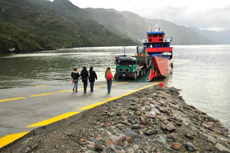
The inland route, without setting foot in Argentina. TABSA's ferry links Puerto Natales with Puerto Yungay in about 41 hours of sailing through the fjords, with stops at Puerto Edén and Caleta Tortel; from Puerto Yungay it's another 570 km (355 miles) of Carretera Austral to Coyhaique. It sails once a week in season, you need to book well ahead, and there's little room for vehicles.
Check the operator's timetable
Weather data: Open-Meteo.com